Lower Mississippi flood plain map info sessions next week
MISSISSIPPI MILLS – The Mississippi Valley Conservation Authority (MVCA) will host two public information centres on updated floodplain mapping for the lower Mississippi River next week.

“The sessions will share project information and gather feedback,” the MVCA released in a statement.
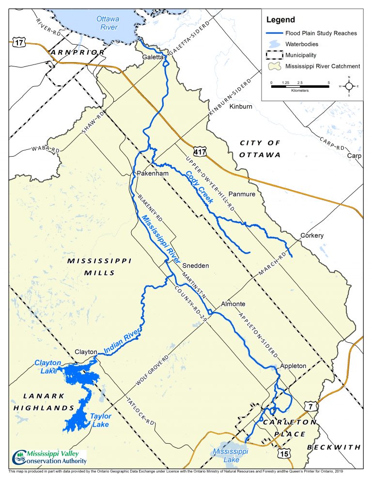
The MVCA has updated floodplain mapping for the Mississippi River downstream of the Hwy. 7 bridge in Carleton Place to the Ottawa River.
The session covers Clayton and Taylor Lakes, Mississippi Lake, Cody Creek, Indian River and the Mississippi River from Carleton Place to Galetta.
The first session will be held in Carleton Place at the MVCA head office on Tuesday, Dec. 3 from 4:30 p.m. to 7 p.m. at 10970 Highway 7.
The second session will be held in Pakenham at the Stewart Community Centre on Wednesday, Dec. 4 from 4:30 p.m. to 7 p.m. at 112 MacFarlane St.
For more information contact Water Resources Engineer John Price at jprice@mvc.on.ca.
To see the maps, click here.


